Tropical Storm Wutip gaining strength, not yet a threat to Taiwan
熱帶風暴「蝴蝶」增強但尚未對台灣構成威脅
Rare February tropical storm continues to intensify in the Western Pacific, not yet on track to strike Taiwan directly
TAIPEI (Taiwan News) -- Tropical Storm Wutip, a rare cyclone for February, has continued to gain strength in the Western Pacific and could soon become a typhoon, but forecasters do not currently believe it will have a direct impact on Taiwan.
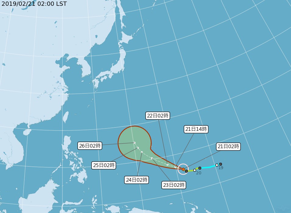
As of 2 a.m. this morning, the Central Weather Bureau said that Tropical Storm Wutip had a radius of 150 kilometers and was 3,810 kilometers east-southeast of Taiwan's southernmost tip of Eluanbi moving west-northwest at 19 kilometers per hour. It was packing maximum sustained winds of 108 kilometers per hour and wind gusts of up to 136 kilometers per hour.
The CWB predicts that Tropical Storm Wutip will develop into a typhoon within 12 hours. However, it is not currently believed that it will have a direct impact on Taiwan.
Ken Kleeschulte, lead meteorologist with the National Weather Service Guam office, told Pacific Daily News that tropcial storms are rare in the Western Pacific in February. Kleeschulte said the reason is because stronger upper level winds this time of year hinder development, and those that do form, move northwest to follow the path of least resistance.
CWB map of Tropical Storm Wutip's projected path.
